
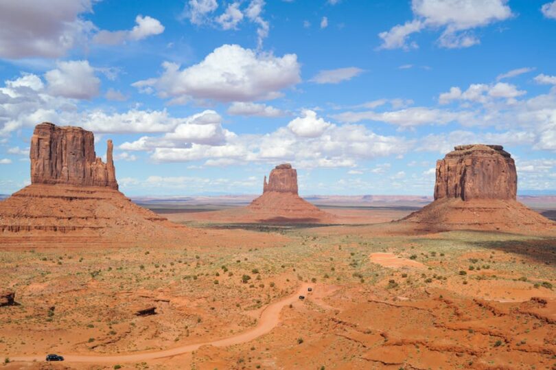
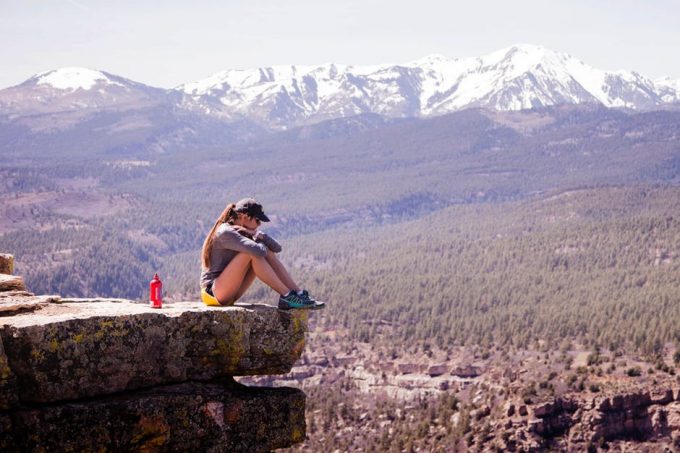
When people talk about Arizona, they speak about its capital of Phoenix, the stellar universities in the state, that enrich the educations of so many students every year, and then people think about the Grand Canyon – geologically aged at 5 – 6 million years old and said to be the location of some of the best hikes in Arizona for homo-sapiens since our first steps on the soils of the Americas, some 15,000 years ago.
The 277-mile in length gouge in the earth that, at certain intervals, have dips and falls to the river below ranging a mile drop. It is truly a wonder of the world, a revel to the human eye, and a masterpiece of nature. Arizona has much more to offer by way of natural, unbelievable beauty in is plentiful landscape.
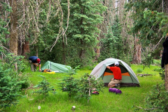
The state boasts over ten national parks to hike, camp, skip, jump, and run through. All with adverse similarities and obscure differences. It is a hell of a state for those into their hiking, though, more than anything else. Finding the perfect spot for you and hiking needs of the modern homo-sapien hiker can be tricky with such a plethora of areas to choose from.
A little research into the land can do a world of good when it comes to your next trip, so let us take a look at the best hiking trails in Arizona, their attributes, what makes them unique and worth seeing. So fill your day pack that you require, and let’s get hiking.
Let’s Start Slow, With Some Simple Hike Trails
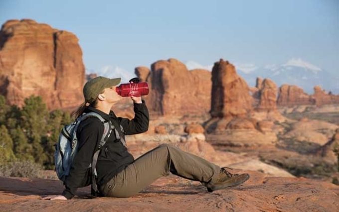
Starting with some of Arizona’s less formidable trails is merely to ease us all into the where and the what that Arizona has to bring; but know this, that only because these hikes are easier on the foot than traversing down the banks of the Grand Canon by way of path or by abseil, does not make them all 100% safe.
So stay ever vigilant, keep your party safe, and remember to have fun in the promise. Now, after that brief note of caution, onto the trails. Why not see our piece on hiking safety 101 for newbies and learn more.
Reavis Ranch found deep in the Superstition Wilderness
Named after Elisha Reavis; a hermit who had come to settle up in the mountainous region in the late 1800’s. An elusive man who spent most of his life either teaching elementary schoolers, divining for gold in the most tumultuous regions of the state, or fighting in the many Indian Campaigns of the time.
As well as owning the first library of books in the Superstition Mountains, killing a bear using a gun that misfired, and rearing horses and mules, he is best known for his planting of an apple orchard 700ft in elevation. A working orchard that surpassed its planter and continues on some hundred years later.
The ranch and surrounding areas have turned into hiking tourist attractions as of late, where the views are stunning and the apples are plentiful, free to those travelling through the orchards.
This trail is for those interested in the deep history of the gold rush of the late 1800’s outside of California, beautifully kept meadows and orchard, and if you wish to find something as amazing as pine trees just above the blazing heat of the desert sands of Arizona.
Flat Iron, the connection trail to the Superstition Mountains and Four Peaks Wilderness
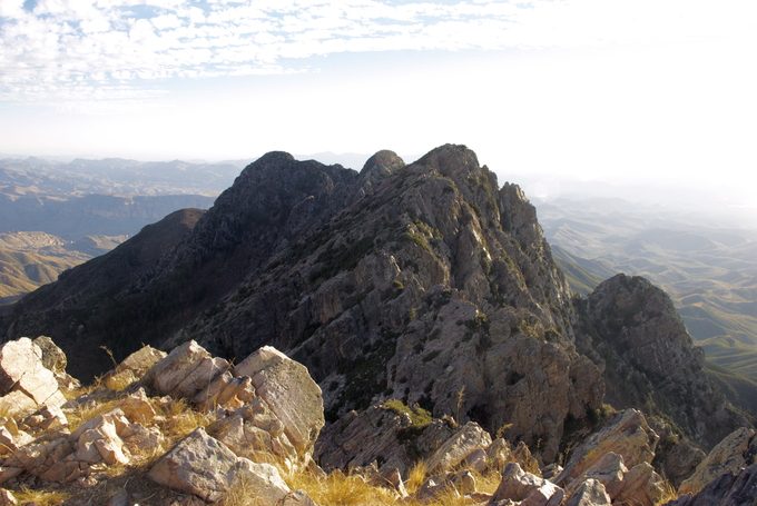
Another trail of note in the Superstition Mountains is that of Flat Iron. Also known as the Siphon Draw, this is a little less a walk in the park as it is more of a trek through the a rocky terrain that once surpassed will make you feel like a king of all that surrounds you.
A six mile round trip through the rough of the Superstition Wilderness, with some of the most prominent and bewildering rock formations that you are likely to find in the great state, this hike is well worth the effort of its traverse.
This hike is not recommended, though, right after even the slightest of rain falls, as the majority of its paths is made up of slick rock which is not fond footing when slippery.
The gaining of both of the territory’s names are interesting in of themselves, Flat Iron is aptly nicknamed for a large protruding spike of rock that stands at 4,800 feet in the air, and the name of the land Siphon Draw came from the name of the trail.
Browns Peak – Prominent in the Four Peaks Wilderness
A beautiful mountainous pass, found out east of Phoenix in the northern region of the Four Peaks Wilderness. Brown’s Peak is the highest of the four peaks in the territory at over 7,000 feet tall. The path takes you all the way up to the summit, which offers an incredible view.
A good sized portion of the entire state of Arizona, and even the highest mountain in the state Mount Humphrey’s, can be seen on a clear day up there.
As well as being revered as an all natural crows nest, the area that surrounds Brown’s Peak has a large black bear population, so be careful when on the trail and stay in packs. Do not let the presence of bears be of alarm, as they stay away from hike trails and rarely cross them unless majorly provoked. Also, our article on how to prevent wild animal attacks is a good-read, so check it out.
From Molehills to Mountains – Higher Elevated Trails
Mount Wrightson, found just outside of Tucson, in the Santa Rita Mountains
Just over 9,000 feet, Mount Wrightson looms over the nearby city of Tucson in an almost protective fashion. Found in Madera Canyon of the Santa Rita Mountains, this mountain’s peak offers an incredible panoramic view of southern Arizona.
If you make it to the summit on a clear enough day, you can even be able to see parts of Mexico as you gaze across the landscape. There are two trails available to the public for reaching the summit, and they both cross one another making a classic figure 8 symbol. Check out our article on the best outdoor camera for longer lasting photos.
The shorter trail of the two at 10.8 miles round trip is the Old Baldy Trail, and three longest coming in at 14 miles round trip, is known as the Super Trail. As mentioned before, both trails lead to to the mountain’s summit, and cross over one another. So the only question you need ask yourself is can I make those extra four miles?
Mt. Baldy Loop looming over the top of the White Mountains
Not to be confused with California’s Old Baldy Mount San Antonio, Mt. Baldy of Arizona shares the same beauty and majesty as its cross state cousin, though towers a lot higher than the SoCal treasure. There are two main hiking trails available for the general public to take with two different peaks to achieve on the hike.
Unfortunately, if you are not a member of the White Mountain Apache Tribe, you are not permitted to make it to the true summit of the mountain. But there is beauty in both the public trials of West Baldy #94 and East Baldy #95, and the connection path, #96, that turns the whole trail into a perfect loop. A lot of fun in taking these paths, with some incredible views to compensate the tough journey.
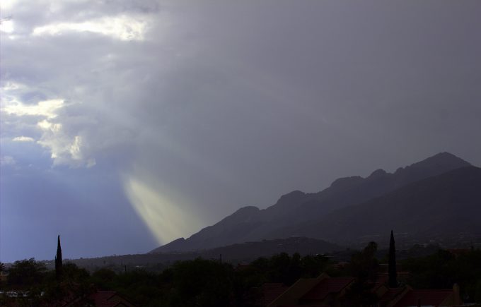
Mount Kimball of the Catalina Mountains
Another mountain that stands close to the city of Tucson, but this time found in the southern peaks of the Santa Catalina Mountains. Mount Kimball is the highest peak in that region, and is what is known as a ‘Sky Island’ – a mountain with its lower slopes deserted, cracking and hot, but the higher you go, the more vegetation and even forestation is found on the higher you get.
The mountain trail is best for seasoned hikers as it is a steep climb on the way up to the summit, and even then can be a tricky trail to hike. Like many of the great mountains in Arizona, this hike is giving you the option of what trail to walk up; Finger Rock Canyon or by Pima Canyon.
Both will get you to the summit of Kimball, they just provide different starting routes. Finger Rock Canyon starts you off on a major road that lead to foothill paths, whereas the Pima Canyon trail starts further west and cuts through many other trails along the way. Both are the same level of difficulty to hike up.
Mount Humphrey’s – Highest Mountain in the State
Mount Humphrey’s stands as the tallest mountain in the entire state of Arizona, its peak at 12,633 feet, makes it less of a hike and more of an expedition. Yes, people, before you have come and planted their proverbial flag, but you know what they say, “you gotta do whatcha gotta do”.
Humphrey’s Peak is the hiking trail used to scale the sides of the mountain. The mountain is found a few miles out of Flagstaff, Arizona, and helps form the Kachina Peaks Wilderness Area, that takes up nearly a 18,000 acres of land within the Coconino County.
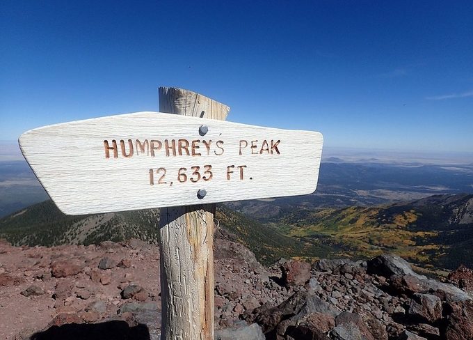
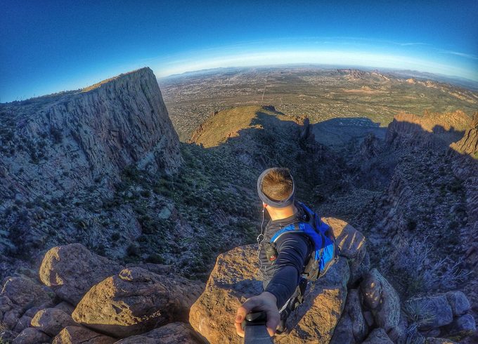
The mountain was named after General A. A. Humphreys, who worked for a time as US Chief of Engineers. The views from the summit of Mount Humphrey are truly remarkable and will brighten up any photographic portfolio; you just have to be proficient enough a hiker to make it all the way to the top.
For Those Opting for the Scenic Route
Kendrick Peak – a lesser Humphrey’s Mountain
Those who wish for a less grueling hike and climb than that offered by Humphrey’s Mount, then you should be heading over to Kendrick Peak; a less intense elevation at 10,000 feet, which still allows bragging rights for you and your party.
Just shy of Flagstaff and an hour from Phoenix, the state’s capital city, stands Kendrick Peak. Found in the San Francisco volcanic field, a 1,800 square mile area filled with over six hundred volcanoes. Some of which have been geographically aged at around six million years old, and the youngest at around a thousand.
So, even though the area has not seen a deadly eruption of one of the volcanos for some years, does not mean that it is wholly advisable to stray too far from the beaten hiking path. It is still a fun trail that afterwards grant you the bragging rights of hiking through a volcano field.
Oak Creek Canyon, Sedona
Sedona is an area of Arizona that is plagued, and bettered, by steady and unrelenting tourism attractions, which makes it a hard place to find and maintain a little bit of solitude. Though there is a small area, within a small canyon, where peace and quiet should really be present in its name. At the West Fork of the Oak Creek Canyon, beauty and serenity can be found with ease.
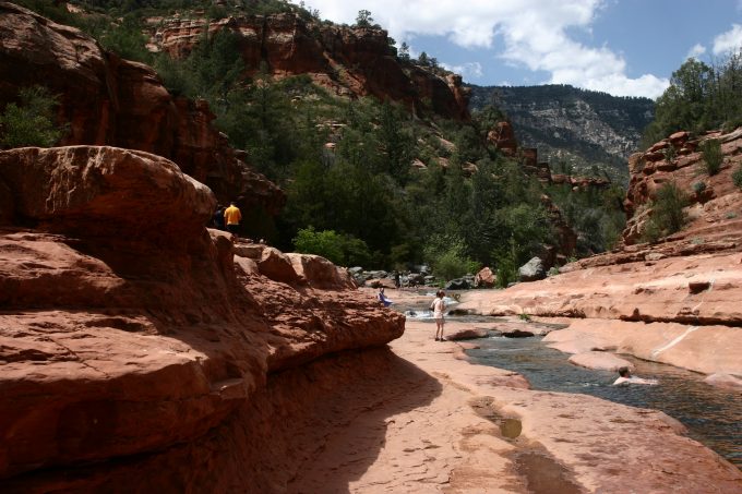
A hike trail lay deep in the east of the tourism, hiking down to this river bed enclosing feels like something out of an old western film. The waters give the looks of those ripe for divining, and are cool to the touch as you trail through. A real refreshing experience to travel to and through.
Havasu Falls. Visit as long as you obtain permission
The beauties of the Grand Canyon never cease to amaze people. Like the fact that in the middle of all of that dry earth, scorching deserts, its high peaks and mountains, there cascades deep and mystic waters for us to take our time in hiking to, and then spend the rest of your day diving into the scenery.
Majestic waterfalls are awaiting you just within the Havasupai Indian Reservation, one of many located in the state of Arizona, so that means that these waters are only accessible to you after obtaining a special permit to use the land for hiking through and camping on.
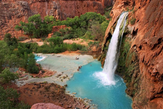
But the turquoise rich, waters, are so worth the hassle of the permit offices. One of the other minor hiccups is the fact that the car park and main entrance are both located a smooth downhill climb from the campsite – which makes for a steady climb to get back to your vehicle so pace yourself.
With photogenic scenes of raging white waters protruding from a mouth, cut out of the red rock holding the valley together, who needs Instagram filters? The Havasu Falls are simply stunning and they are a must see during your time in Arizona. Make sure you check it out.
Enjoy Your Hikes and Stay Safe Out There
Regardless of which of these magnificent trails to hike down, to the top of one of the many mountains the state has to offer or plunge deep into the valleys and ravines in the most famous canyons the country has to offer, you are guaranteed to enjoy yourself and wish that you had more time to explore the next trail head endeavor. If you want to see the other places, check out our article for the choicest trails in the world and be amazed.
Many people say that most of the best hikes in the United States of America are found in Arizona, and after you have taken a few of these trails, you quickly agree. What do you think? Make sure you let us know by leaving a comment in the comments section below.


Great to see Mount Wrightson featured in this article. This is one of the most spectacular places I have been to and I must say that the view from the top of the mountain is worth the hike. I had no idea there was another trail to get to the top of the mountain, but from the description, I must have used the shorter route. I wish I could have known and used it on my way back.
Thanks for sharing your story!
From its description, Reavis Ranch sounds like such a great place to visit given the rich history behind it. Brown’s Peak also sounds quite appealing, given that you can see good sized portion of the entire state of Arizona. I have however noticed that a lot of these trails need good timing especially given the weather limitations. You don’t want to visit these places on cloudy or worse, rainy days.
Good to know!