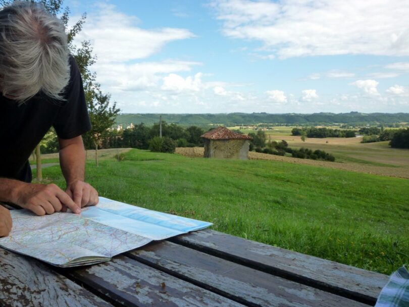
Regardless of the nature of your outdoor activity or adventure, a good map of the area you are traversing will come in very handy. We’ve all seen a map at some point in our lives, even if it was on a TV show or movie, and no matter the complexity, map reading will become a very natural and easy activity for you once you know the basics.
Every map holds a narrative of positions, locations, destinations, distances and routes. With maps, you can easily locate your position relative to other positions and you can determine the best routes to your desired destination. Technology is now advanced and we have things like Google maps on smartphones, but it will do you a world of good to know how to read a map. There is so much that can go wrong with technology and it has limitations, such as requiring power and internet access to be functional, so it is not wise to place all your eggs in that basket.
With a map and its sister tool, the compass in your hands, you are already equipped with the two must have gear for your backpacking and outdoor adventures. No matter how crazy technology gets, it might never be able to completely replace a good old fashioned map and a magnetized compass.
The science of reading maps is pretty straightforward. Those little details you find on typical maps might seem a little confusing but with just the right guidance and demonstrations, you will have all the answers you need in no time.
Map Types
Before you do anything, you must first understand that there are various types of maps available and each is suitable for its own purposes and has its own peculiarities. There are road maps, tourist maps, topographic maps, and sectionals. For simplicity’s sake, we’re only going to talk about topographic maps, as these will be the most helpful for you while hiking.
Topographic maps are maps that feature a lot of information about the geography of a particular area. Unlike the traditional flat and two dimensional road maps that only feature points of interest and routes, the topographic maps will help you orientate yourself with the landscape by conveying all the information you need about the physical reliefs of that area.

There is detail about relief through contour lines. With the information on topographic maps, you have a better understanding of the general landscape and terrain, you know where bodies of water are located, forest cover and a bunch of other stuff that is very important to hikers and backpackers and adventurers. The topographic maps or topo map as it is sometimes called is your best bet for any kind of outdoor expedition.
These are some of the things you are sure to find on your average map:
- Coordinates
- Scale
- Symbols
- Latitude and longitude
- Contour lines
- Legend
Coordinates
You should already know by the positions of north, east, west and south on a Cartesian compass. If you draw a cross sign, north is pointing upwards, and east is pointing to the right, west to the left and south downwards. Most maps are drawn with their tops pointing to the north. This is the typical orientation of maps.

A lot of the maps will have a little symbol, sometimes a compass rose on the top left corner. But for those without this indication, you can just assume north to be at the top. So you can determine where your other cardinal points are on the map once you can figure out where north is.
Scale
Naturally, actual distances on the ground cannot be replicated exactly on a piece of paper. Therefore every map requires a scale which scales down very long distances into shorter ones on paper. The maps scale shows you the ratio of actual distance to the distance depicted on your map. If you see a ratio such as 1:1000, this means that a unit on your map equals 1000 units on the ground, depending on whether you use centimeters or inches. These units can be in miles, kilometers or whatever unit of distance measurement.
For your convenience you should pick out a map with a specific type of scale depending on the nature of your expedition.

If you are going to be walking, a map with a scale of 1:25,000 is suitable.
How to Use Scale to Determine Actual Distances:
Just as an example, if you have a map with a scale of 1: 25,000 and a distance from point A to point B on your map is equal to 6 inches. Then the actual distance on the ground will be 6 x 25,000 which amounts to 150,000 miles or kilometers, depending on your unit of measurement.
Latitude and Longitude
Latitude and longitudes aren’t the most important feature of a map for the user who is just moving from point A to point B in a city. But for those that are sailing the ocean, flying the skies and traveling great distances that typically don’t have all the markers you would find in a road map, latitude and longitude are very essential.
Latitude is the distance between the equator and the north or the equator and the south. This distance s measured in degrees. Longitude is the distance east of the Greenwich meridian or west of the Greenwich meridian. Also measured in degrees. The latitude is indicated on the side of your map with numbers and the longitude is indicated at the top and bottom.

The degrees that represent the latitude and longitude are each divided into 60 minutes. Each minute is the equivalent of 60 nautical miles which amounts to about 69 miles or 111km on the ground.
The point at which the latitude and longitude lines intersect at your location is your reference point.
Contour Lines
It is important you know how to read contour lines. Contour lines show you how high or low a point is on a map. Each line describes a height above sea level and with this information, you can point out mountains and valleys and plateaus. Contour lines that are close to each other indicate a steep gradient and those that are further apart indicate a flatter gradient. Not very many topographic maps have these, but if you’re willing to shell out a bit of extra money, they can come in handy.
Legend
Most maps or at least the good ones all have a legend. Legends are a key of symbols that tell you what every symbol used on the map refers to. This helps you understand how the map represents data and this is crucial to understanding the map.

Because maps are a scaled down version of actual topography and landscape, these symbols are integral to the usefulness of maps. Shapes and colors are both used as symbols to represent various things. There is an incredibly long list of symbols that can be used, some universal and some specific with peculiar variations so you can easily refer to the legend on your map to tell you what every symbol on that map refers to.
How to Get from Point A to Point B with Your Map
Now that you know what you need to know concerning the features and representations of maps, how do you use all that information to get from one point to another? How do you travel from your location to your destination? Using maps to navigate distances can be broken down into 4 major steps and these are:
- Determining your location
- Finding your desired destination
- Using the map
- Planning your routes
Your Location
Before you make any plans on how you want to travel from one point to another, you must first determine your location on the map. If you don’t know where you are, there is no way you can know how to get to your destination. To find your location, you can use a compass. All you have to do is align the map with the directions indicated on the compass and figure out your location through the latitude and longitude. Our tips on how to use your compass in adjusting declination is a big help for experts and newbies alike.

If you don’t have a compass, you can find your location relative to conspicuous landmarks and big natural geographical bodies such as rivers and mountains. For a road map, road names, street names and buildings will help you to find your location. When you determine your location on the map, mark it with a marker or something.
Your Destination
After you must have determined your location, you now have to locate your desired destination on the map. If you simply wish to go directly from one point to another, all you have to do is mark those two points and link a direct route. However if you have a bunch of places to go to, you might want to do a little more route planning such that you get to visit all your points of interest in one swoop without having to go back and forth.
Using the map
This is where you put all that you have learned about maps to good use. You make sure you use the maps scale to estimate distances and time of travel and use the maps legend to take note of all the landmarks and locations/points of interest. Why not see our article on Appalachian trail map and be amazed how apps enable you to make a memorable experience.
Plan your routes
Now that you know where you are, you know where you want to be, and you understand the map, all that remains is to determine how best to get there. Having marked these points on the map and taken note of all the checkpoints and markers, you can begin your journey from point A to point B.

There are various available options for the maps that you have access to depending on the nature and factors that surround the area you wish to take your journey. The USGS is a big name in the supply of topographic maps in the United States and these maps are designed to cover quadrant like areas called quadrangles. It will surprise you to know that every part of the United States is covered by these maps and they are quite easy to use and easily accessible.
Some private companies are also into the business of making enhanced versions of the regular maps with a lot more detail and constant updating. These too are very handy if you can get your hands on them. Lastly, most public areas or lands that are owned by the government such as parks, reserves and recreational spots have their own maps that cover the land within their jurisdiction, and these maps are usually handed out for free.
These maps will have most of the information you will need about their land. The only drawback here is that due to the small scale nature the maps might lack some of the little details you might be interested in.

It is very important that you don’t just jump into relying only on your maps for direction and navigation until you are sure you know everything there is to know. You don’t want to get lost on your fist remote hike if you are still a beginner. You have to take a lot of precautions when going out on hikes as a beginner. To give you more insight, check out our guide on hiking for beginners – a must-read!
Try to go places that have a lot of markers such as rivers, mountains and parks, and preferably areas that aren’t so remote where you can easily run into people who can help you out when you feel like you are a little lost.
As you begin to get the hang of map reading you can then begin to navigate more remote areas on your own. If you are a complete beginner, it is wise to have an instructor with you and build your navigation skills under supervision at your own pace instead of lunging into the more advanced stuff which you may not be able to handle. You can also explore different terrains with a friend as two heads are definitely better than one and you can both help each other out when you get confused. Plus you’ll have way more fun together.
For more hiking safety, see our guide on the best GPS Garmin devices to help you navigate your way.


I was one of those people who grew up thinking I was spatially challenged and I needed to depend on others for directions. But I got tired of labeling myself this way. I made an effort to get out of my comfort zone and read more about map reading to help me make more sense of it and to eventually get more comfortable using it on my own.
A great way to improve your skill in reading maps and understanding the use of a compass is to join a local orienteering club. I know most people would appreciate learning with others and having someone to talk to versus just opening a book. These orienteering clubs host events for people at various skill levels. It is also a great way to test your newly acquired map reading skills in a safe environment.
That’s great Judy and thanks for posting this. I’ve seen a lot of people being empowered just by learning skills they don’t think they can learn. I’m so happy that you got out of your comfort zone to do something for yourself.
Map reading is a very useful skill. And when you’re an outdoor enthusiast, it’s an essential skill to have in order to navigate yourself around a specific area.
Good tip Stephanie! Learning with others is more fun and there’s a lot of people who can help you with what you don’t understand. It’s also a great way to bond and test your skills with other people who share the same interest.